


NSW government report that applying to install jetties and pontoons on estuaries just got easier.
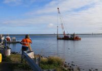
Many people dream of owning a coastal waterfront property where they can build their own jetty or pontoon.
However, as most foreshores and waterways in NSW are on public land, landholders are required to gain a variety of approvals to build a jetty, pontoon or similar structure on the public land adjoining their property.
As gaining approvals can be both time consuming and costly, DPI Fisheries along with Transport for NSW and NSW Crown Lands (Department of Planning and Environment) have teamed up to make it easier to apply to install a pontoon or jetty.
Until recently, to build a jetty or pontoon, all landowners needed to seek advice from DPI Fisheries and Transport for NSW before approaching Crown Lands for landowner’s consent and their local councils for development approval.
Now, starting with the Richmond and Brunswick Rivers, some landowners will be able to skip contacting DPI Fisheries and Transport for NSW once they’ve checked on their river’s Domestic Waterfront Structures Strategy to see if their property is in a pre-assessed ‘green’ area.
Domestic Waterfront Structures Strategies (DWSS) are new online maps on the DPI Fisheries Spatial Data Portal that show waterfront areas that are appropriate for building waterfront structures.
They have been created by analysing the suitability of riverfront areas for installing jetties or pontoons by looking at who owns the land and its social and environmental value.
Domestic Waterfront Structures Strategies use a traffic light system to show a locations suitability for building waterfront structures, with areas shown in green requiring less and more streamlined approvals than orange, and areas mapped in red being unsuitable for gaining consent to build a waterfront structure.
DPI Fisheries Project Manager Alex Wray-Barnes said the DWSS foreshore mapping project, funded by the Marine Estate Management Strategy, is an example of government agencies working together to make approvals simpler and easier for the public.
“This new system will ensure the approval of foreshore development is more streamlined, consistent, transparent and fair,” he said.
“This is the Marine Estate Management Strategy in action. Mapping out approval outcomes at an estuary-wide scale improves coordination between agencies and simplifies the approval process for landowners,” Mr Wray-Barnes said.
He said that Domestic Waterfront Structures Strategies are planned for all major estuaries on the NSW coast over coming years.
“We started on the far north coast with the Richmond and Brunswick and will be completing the Evans and Tweed estuaries in coming months, after which we will be completing DWSS for several estuaries on the south coast. This means waterfront landowners (and people looking at buying land) can quickly see if they would be likely to obtain approvals to build structures like pontoons and jetties.“
Lynda Hourigan, Project Governance Officer Transport for NSW (Maritime), said this new resource is a win for waterway users of NSW.
“It’s going to be a valuable resource for the public and stakeholder agencies. It is very easy to navigate.
A short video outlining the approval process for building pontoons and jetties and how to access the Domestic Waterfront Structures Strategies has been released by DPI Fisheries as part of the project. The video and DWSS for the Richmond and Brunswick River estuaries and more information on the strategies in development can be found at the Marine Estate Management Strategy (MEMS) project profile page here.