


From the pages of the NSW Marine Estate come these images showing the change to river entrances over the years.
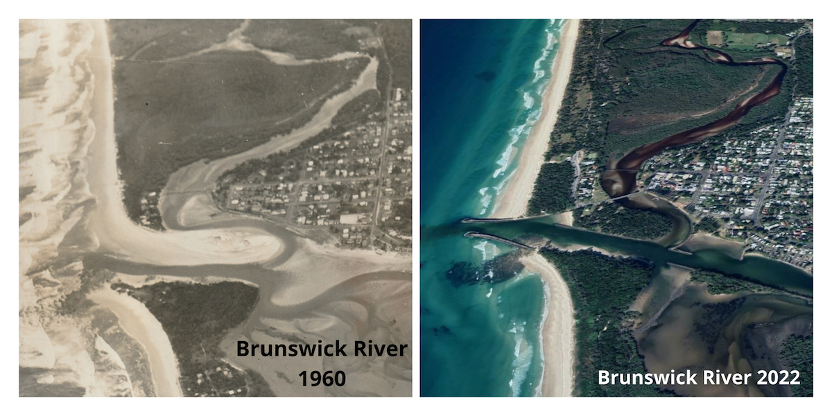
The Brunswick River back in 1960 compared to now.
You can see that the construction of breakwaters has totally changed this river mouth.
These images have been taken from an audit of NSW breakwater structures conducted by DPI Fisheries.
The audit aimed to review all of NSW breakwater structures and look at ways we could better manage them for both the marine environment and for users of breakwater structures.
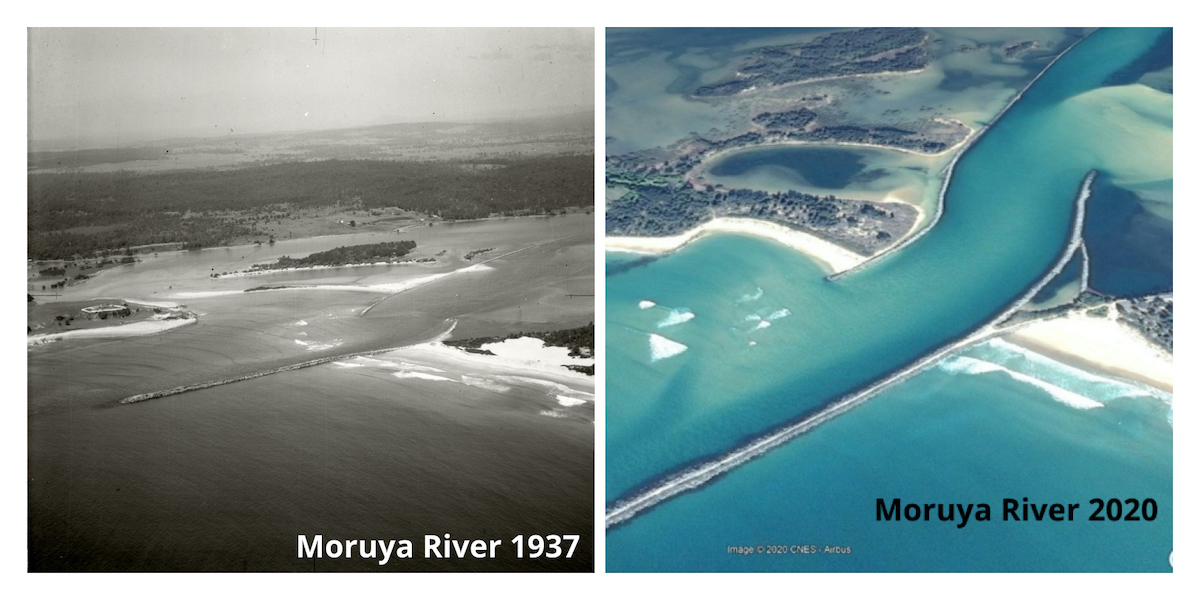
The Moruya River entrance since 1937.
You can see the construction of breakwalls on both sides of the channel has allowed areas of land to be reclaimed.

The above photos show how the breakwater structures (and boat harbour) at Bermagui have completely changed the lie of the land and how the river meets the sea.
Breakwaters and training walls are large structures built of rock or concrete and positioned in the coastal zone.
Created to protect some foreshores from erosion and create harbours, or safe ports, you can see from these images that they can alter the topography.
Many NSW breakwaters are more than 100 years old, and their design did not consider their environmental impact.
You can find more amazing historical coastal aerial images by checking out the Fish Friendly Breakwater audit.
The Fish Friendly Breakwater Maintenance project was funded under the NSW Marine Estate Management Strategy.
Photo credit: The 1937 aerial photographs of Bermagui and the Moruya River are part of the Adastra Collection, a collection of approximately 200 aerial images of Sydney and the NSW south coast.