


Savvy Navvy has launched an industry-first new chart annotation tool, enabling boating instructors to turn digital charts into interactive learning tools for the next generation of boaters.
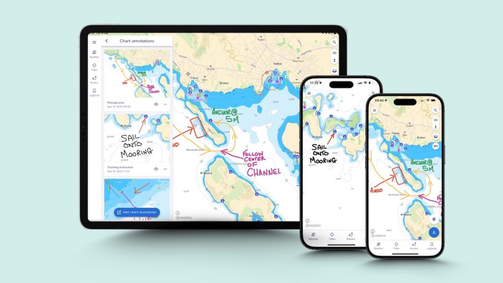
Adding personal chart annotations enables users of the marine navigation app to draw and mark up on charts, save and share with their network – a digital-first alternative to paper-based plotting.
“We’ve been working with boating instructors worldwide for several years and developing features in the Savvy Navvy app to meet their needs. Chart annotations enable instructors to transform electronic charts into a dynamic teaching tool, making lessons clearer, safer and more memorable. They can map out scenarios, highlight hazards, and adapt lessons quickly. As more instructors embrace a digital-first approach to navigation, our goal is to provide the technology they need to make boating more accessible, safer, and intuitive than ever,” says David Cusworth, Head of Partnership and Innovation at Savvy Navvy.
Chart annotations is the first in a series of instructor-specific features all built by Savvy Navvy specifically for the marine industry’s ‘Digital First’ rollout. Around one in four RYA instructors are already using Savvy Navvy in their training courses. This year the marine technology company has delivered dedicated webinars to hundreds of instructors across the UK, USA, Australia, and New Zealand, continuing to support the ‘Digital First’ campaign, first launched by RYA in 2023.
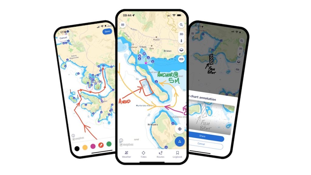
“I am surprised at how much we use Savvy Navvy’s chart annotations. When we can draw our own ‘no-go’ line around a shallow spot for our actual training boat, or drop a pin on a great little anchorage we’ve just visited with notes about what makes it great, the theory just clicks and Savvy Navvy becomes our shared playbook for the day. You see that lightbulb moment for students, and they leave with a chart full of their own notes and memories, which is just brilliant,” says David Killpack, Principal at Sunshine Sailing Australia.
Savvy Navvy, often referred to as ‘Google maps for boats’, has had over two million downloads globally. The revolutionary Savvy Navvy app solves vital navigation issues for boaters, kayakers, paddleboarders and jet-skiers. Unlike any other navigation solution, Savvy Navvy provides smart routing — giving users the optimal route and dynamic ETAs based on real-time data: departure time, chart information, weather conditions, tide, boat specifications and local regulations.
Chart annotations will go live to Savvy Navvy users worldwide next week. To find out more about the Savvy Navvy app, or for qualified instructors to access their Professional Edition account visit www.savvy-navvy.com/instructors.