


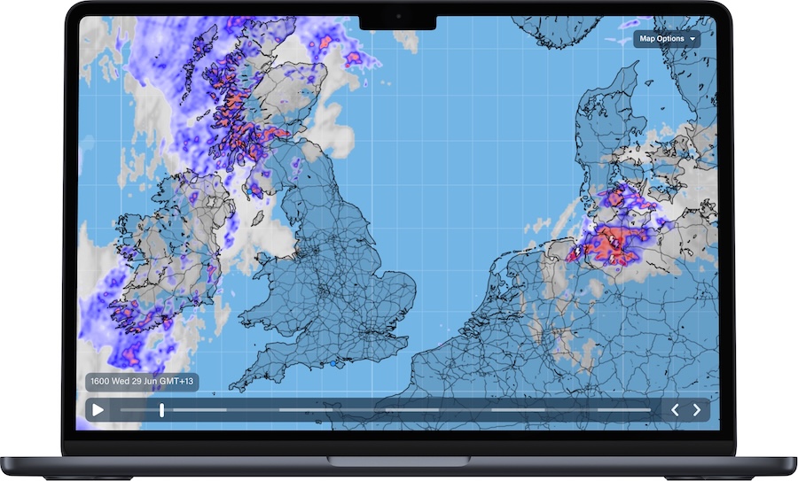
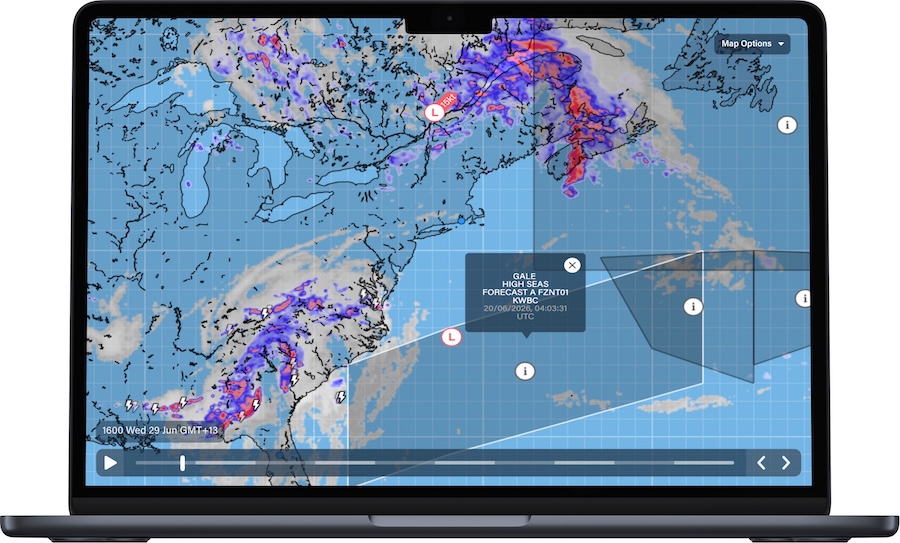
PredictWind has launched Global Rain Radar and Hybrid Satellite Imagery, giving sailors a clearer view of incoming rain and cloud cover, hours before it hits.
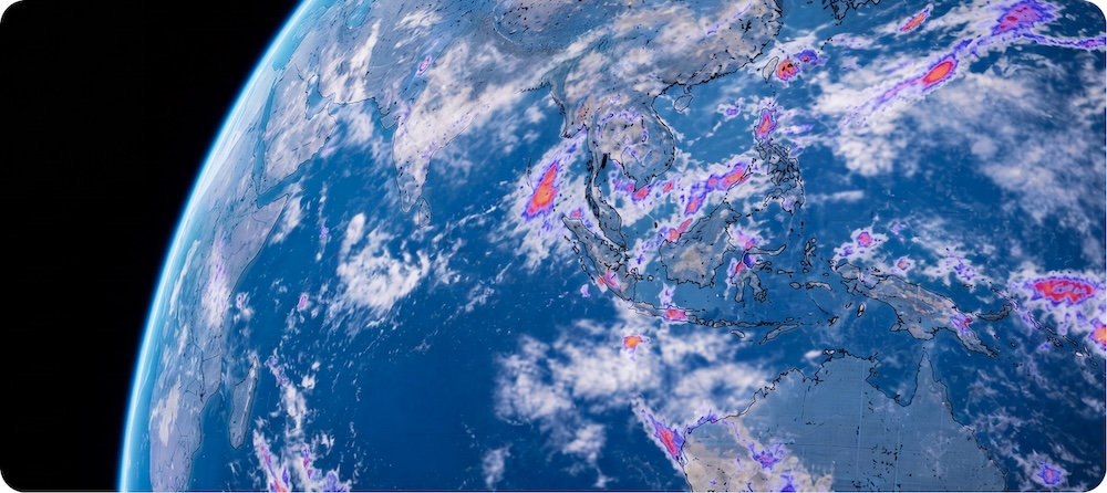
The update blends imagery from five major weather satellite systems into a single global view, then layers radar on top, so sailors worldwide can check the forecast against a live picture of the sky and make a confident call before they head out.
What’s new:
Global Rain Radar – Track rain across the entire planet, from ocean to ocean, no matter where you’re sailing.
AI Rain Forecasts – High-accuracy rain forecasts updating every 10 minutes, so your picture is always current.
Hybrid Satellite Imagery – See cloud cover in sharp detail, day or night, refreshed every 10 minutes.
Integrated GMDSS Alerts – Understand what the radar is showing in the context of your safety, with official safety alerts visible on the same screen.
![]()
![]()
“Global rain radar has been on our development roadmap for a long time. Rain is one of the hardest elements to forecast at sea – it moves fast and doesn’t always follow the models. This update is our answer to that. We’re proud to continue levelling up our features to give users the visibility they need to make confident, safe decisions on the water, with a clear view of what’s coming.” – Jon Bilger, PredictWind Founder.
Global Rain Radar and Hybrid Satellite Imagery is a paid feature that sits alongside PredictWind’s existing suite of routing, forecasting, and safety tools, giving users a clear read on conditions from planning to passage. Both features are available now on the PredictWind app and website. Hybrid Satellite Imagery is also available on the Offshore app. All are unlocked for Basic subscription users and above. For more information, visit predictwind.com.