


Speed limit reminder
Speed limits on Tasmania’s waterways exist to keep everyone safe. Excessive speed is a common factor in serious incidents, particularly in commonly used areas such as close to shore, boat ramps, moorings, and swimming areas.
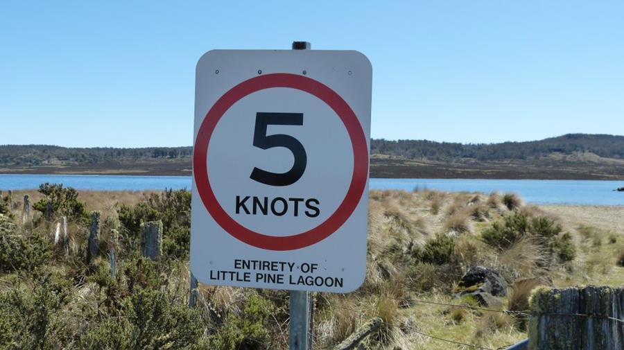
Please remember
5-knot maximum speed limit applies to the following areas:
- within 60 metres of vessels, marine structures such as jetties and wharfs, shorelines and in 5-knot zones
- within 120 metres of a swimmer, diver, or any other person/people in the water.
Freestyling and non-directional driving such as donuts and tight turns are not permitted within 200 metres of a person in the water or the shoreline, where a building or house is within 100 metres of that shoreline.
Safe speed is not just about a specific signposted limit, it is also about operating safely for the current conditions. In Tasmania, if you are caught exceeding the relevant speed limit, you may receive a penalty.
Flares and Electronic visual distress signals
When something goes wrong on the water, distress signals are essential visual indicators to alert others of the situation. Flares are the traditional alert option and now approved electronic alternatives available for use.
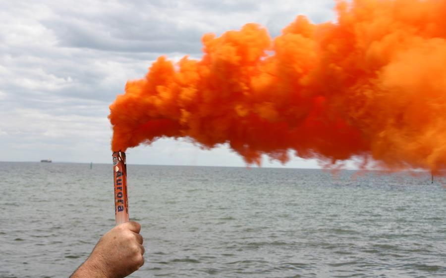
Flare carriage for different waters:
Smooth waters » Recommended only
Sheltered waters » 2 x Red Hand Flares and 2 x Orange Smoke Flares
Coastal waters » 2 x Red Hand Flares, 2 x Orange Smoke Flares and 2 x Red Parachute Rockets.
Electronic visual distress signals (EVDS)
- may be used in place of 2 x Red Hand Flares and 2 x Orange Smoke Flares
- if you carry an EVDS, you must also carry a VHF radio and a GPS-enabled EPIRB, registered with Australian Maritime Safety Authority (AMSA)
- EVDS are effective at night but have limited visibility in daylight, so a VHF radio and EPIRB are essential for full safety effectiveness.
Key points for safe use and storage of flares
Store where accessible: Keep distress flares in a clearly marked and dry storage area that is within easy reach.
Know how to use them: Each brand of flares available may ignite differently so please read the individual operating instructions prior to use. Ideally, passengers on your vessel should also know how to operate flares just in case you require backup.
Check expiry dates: Flares have a lifespan of three years from the date of manufacture. Any out-of-date flares must be replaced immediately and disposed of correctly.
Please remember: Expired flares must not go in general rubbish and can only be disposed of at dedicated collection points conveniently located around Tasmania.
Learn more about how to use and dispose of flares
Find facilities before you launch
Whether you are fishing, cruising, or exploring, knowing what facilities are available helps you enjoy your trip with confidence.
Planning your time out on the water before leaving the shore also helps to save time, keep your trip safe and run as smoothly as possible.
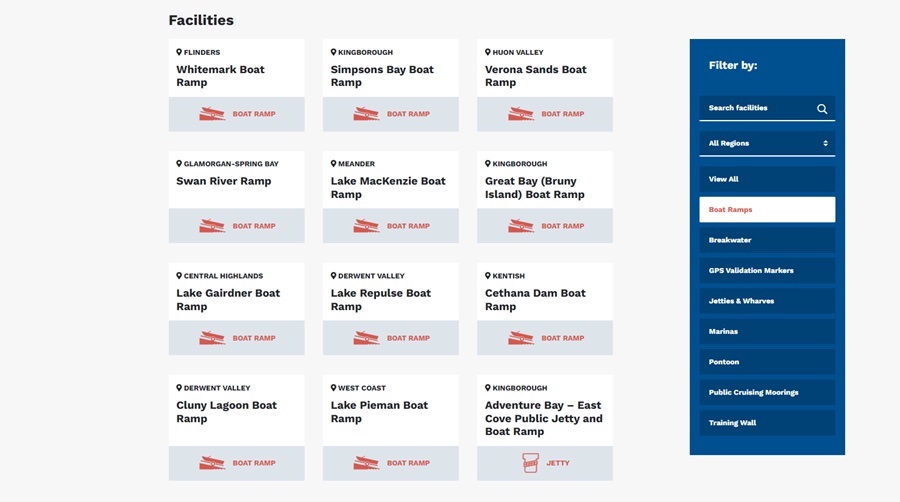
By visiting the Facilities Finder page on MAST’s, you can:
- locate nearby ramps, pontoons and launching points
- check access points before travelling to new or unfamiliar areas
- plan safer trips and avoid delays.
Always check the tides before you go
Tides can have a significant impact on launching, retrieving, and navigating vessels, particularly in shallow waters, rivers, estuaries, and coastal areas. Checking the tide before heading out helps to avoid getting stranded, grounding or risk encountering marine hazards.

Tidal predictions
Tidal predictions are based on average barometric pressure, and changes in pressure can slightly raise or lower the water level. For example, if the forecast low tide is 0.3 metres at 12:00 noon and the average barometric pressure is 1016 hPa, a higher pressure of 1036 hPa (20 hPa above average) can lower the water level by about 0.2 metres. This means the low tide may be only around 0.1 metres.
Even small tidal differences can affect access to shallow ramps, channels, or moorings, so it is important to check both tide tables and current pressure conditions before heading out.
Tip: Always check local tide tables before heading out and allow extra margin when navigating shallow waters or unfamiliar areas. Statewide Tasmanian Tide Tables can be found on the Bureau of Meteorology’s website.
Infrastructure update
Gordon
Planning is underway for the replacement of the Gordon Jetty. Dredging will also be undertaken in the immediate vicinity and works are expected to be completed later in 2026.
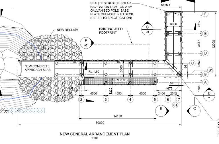
Gordon Jetty plan
Sisters Beach
Final approvals have been obtained, and a contractor has been appointed for a new concrete landing stage at Sisters Beach. Works are scheduled to commence after Easter 2026, with completion expected by the end of June 2026.
Lake Crescent
A contractor has been appointed to construct a new timber walkway at the Lake Crescent boat ramp. Works are scheduled to begin in late February 2026, with completion expected by early April 2026.
Inspection Head
To improve safety and accessibility for smaller vessels and personal watercraft new fendering will be installed and the works are expected to be completed by the end of February.
For more information, visit mast.tas.gov.au