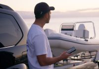


Transport for NSW is trialling powered vessel free zones in selected waterways at Port Stephens to help reduce conflict and improve safety for swimmers, paddlers, and recreational boaters. These zones will temporarily restrict access for powered vessels, including personal watercraft (PWCs or ‘jet skis’) in areas identified as having high levels of congestion or risk.
Port Stephens is one of the busiest waterways in NSW during summer. The initiative responds to community concerns and aims to support safer, more enjoyable experiences on NSW waterways during this peak holiday period. The trial will be supported by on-water education, clear signage, and cross agency collaboration and will operate from 24 December 2025 to 26 January 2026.
Trial locations
Three trial locations have been selected based on safety data and community feedback about high-use swimming and paddling areas:
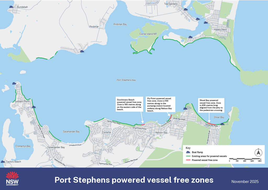
- Dutchmans Beach zone – a 185-metre-long area on the eastern side of the beach
- Nelson Bay Beach (Fly Point) zone – a 230-metre-long area from Fly Point in a southwest direction to a pumping station located midway along Nelson Bay beach
- Shoal Bay zone – a 430-metre-long area westward from the jetty to the pedestrian crossing.
In all locations, powered vessels will be restricted to a distance of more than 30 metres from the shoreline. These sites provide the best opportunity to test how separating certain activities can make the water safer and more enjoyable for everyone.
What this means for you
- swimmers and families – can enjoy popular beaches and bays with more confidence
- paddlers and non-motorised users – will have safer spaces for recreation
- boaters and jet ski riders – will continue to have extensive areas across Port Stephens where powered vessels can operate safely and responsibly.
This is a temporary trial to undertake consultation, not a permanent change. It’s about testing solutions and gathering feedback to help guide future waterway management.
Have your say
We want to hear from everyone who uses or enjoys Port Stephens waterways – paddlers, jet ski riders, boaters, residents, and visitors.
Feedback will be gathered through:
- Have Your Say online platform and QR codes on local signage
- Independent evaluators conducting on-site discussions during the trial
Your views will form part of an independent evaluation that will report back in early 2026.
How the trial will be managed
The trial will be supported by:
- NSW Maritime Boating Safety Officers and the NSW Police Marine Area Command, who will be on the water to explain the rules and encourage compliance
- Boating Education Officers, providing information and answering questions at key access points
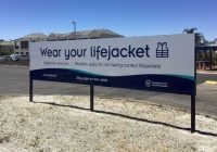
- Clear signage and communications, including maps, FAQs, and social media updates to keep the community informed.
Evaluation and next steps
An independent evaluation will review how effective the trial is in improving safety and amenity.
This will include analysis of:
- incident and compliance data
- stakeholder and community feedback
- observations from enforcement and education staff
The evaluation findings will help determine whether similar approaches could be applied elsewhere in NSW in the future.
Frequently asked questions
What is this trial about?
Transport for NSW is introducing a seasonal trial of powered vessel safety zones in Port Stephens over the 2025–26 summer period. The trial will temporarily restrict personal watercraft (PWCs), also known as jet skis and other powered vessels from specific high-use areas where swimmers, paddlers, and other water users frequently overlap. An aim of the trial is to improve safety and amenity for all waterway users, whilst maintaining access for non-powered vessels such as paddlecraft.
Why is this trial being introduced?
Every summer, Port Stephens experiences a sharp rise in visitor numbers, leading to crowded waterways and a possible increased risk of incidents. While most PWC riders operate safely and responsibly, some areas experience issues where different water activities compete for space. This trial is part of an effort to reduce risk, gather feedback, and test how localised safety zones can help prevent collisions and improve community confidence.
Why was the trial announced so early before it starts?
The announcement was made early to give the community plenty of time to understand what’s planned and why. This trial responds to long-standing safety concerns raised by locals and visitors about high PWC activity in busy areas of Port Stephens. By announcing it well in advance, Transport for NSW can work closely with the community, councils, and local operators to make sure everyone knows how the trial will work and what areas are affected. An independent evaluation will review how effective the trial is, using feedback collected both face to face and online throughout the summer. Transport will share those findings and continue working with the community once the evaluation is complete. The early announcement helps to enhance awareness of the trail and the evaluation process.
Where are the trial zones?
Three locations have been identified based on safety evidence and areas of known high user conflict:
-
- Dutchmans Beach zone – a 185-metre-long area on the eastern side of the beach
- Nelson Bay Beach (Fly Point) zone – a 230-metre-long area from Fly Point in a southwest direction to a pumping station located midway along Nelson Bay beach
- Shoal Bay zone – a 430-metre-long area westward from the jetty to the pedestrian crossing.
When will the trial run?
The trial will run from 24 December 2025 to 26 January 2026, covering the peak summer holiday season when visitor numbers and water activity are high.
How long will the trial last?
The trial is temporary, running for one summer season only. An independent evaluation will follow to determine whether the approach is effective in improving safety, reducing user conflict, and maintaining access and enjoyment for all waterway users. Community feedback will form an important part of this evaluation and will include community feedback collected via Have your Say website as well as direct engagement by the independent evaluators who will be out in the community during the trial. Your input, whether online or in person, will help determine whether similar approaches could be used elsewhere in future.
Who enforces the rules of the trial?
The trial will be jointly supported by NSW Maritime Boating Safety Officers (BSOs) and NSW Police – Marine Area Command (MAC). Their approach will be on education first – helping operators of powered vessels, including PWC riders, understand the rules before issuing any penalties. Boating Education Officers (BEOs) will also be available at key locations to answer questions and provide information.
How will I know where I can and can’t go?
Clear signage will be installed at all trial sites and nearby launch points. Maps and information will also be available on the Transport for NSW website and our NSW Maritime staff will be out and about to help boaters understand the trial zones and the activities that can be undertaken.
How much of the waterway will be taken up by the trial?
Of the 3.4km of available beach across the three trial locations at Dutchman’s Beach, Nelson Bay Beach (Fly Point) and Shoal Bay only 800m of beach length in total is allocated to the exclusion zones. Jet skis and other powered vessels are permitted to land and launch across the remaining 2.6km of available beach in those areas.
For more information visit www.nsw.gov.au/using-waterways-boating-and-transport-information